
Carbon-Neutral that is. That's the buzz-word for activities, industries, and products that don't emit CO2 or Methane as part of their operations or production. And thus, are not contributing to global warming. Here in Alaska there is almost unlimited opportunity to explore wilderness, as it exists in the modern era of air travel and satellite phones (meaning, there really isn't any true wilderness left anywhere on the Earth's surface, since we can always be in contact with someone, and be plucked out if necessary). However, that usually means a significant amount of driving, or even worse (because of greater CO2 emissions per KM of travel), air travel. The smaller the plane the better though, for instance a little Super Cub doesn't burn much more fuel than an automobile, so much better to be flown in somewhere in one of those, than on a fuel-guzzling Twin Otter, or other larger plane.
We are lucky, here at the Alaska Progressive Review, to actually be able to get into some of our "wilderness" carbon-neutrally, right from the front door of the Chugach Front Research Centre, since the Chugach Mountains rear up only 2-3 KM behind our neighbourhood.

Our first foray this week on an expedition of this kind went very well, and left us anticipating more, both for long day trips/fast-packs or skis, or multi-day outings.

We set out thursday last late in the day, around 1600, as we were waiting (in vain) for the rain to let up. My plan was to ride my mountain bike, with Mattie and Homer attached, to the North Fork Campbell Creek trailhead (my name for it, it is not listed in any guide books), to save a little time. Then pack right in. Homer was wearing a pack containing their food. Since he always stays right with me, he won't lose it running off after marmots or ptarmigan.
Homer ran the Yukon Quest in 2003, the toughest sled dog race in the World, 1600 KM of cold, hard trail from Whitehorse to Fairbanks. Led by our friend Eric Nicolier in Fairbanks, who was a serious musher then. That was when Homer was in his prime, at seven years of age. Even now though at 14, he keeps up with Mattie and I in everything we do. So he's used to being in the traces, and behaves superbly, attached to the bike. Mattie actually picked up the procedures quickly, in the few other times we've done this, so it goes very well.
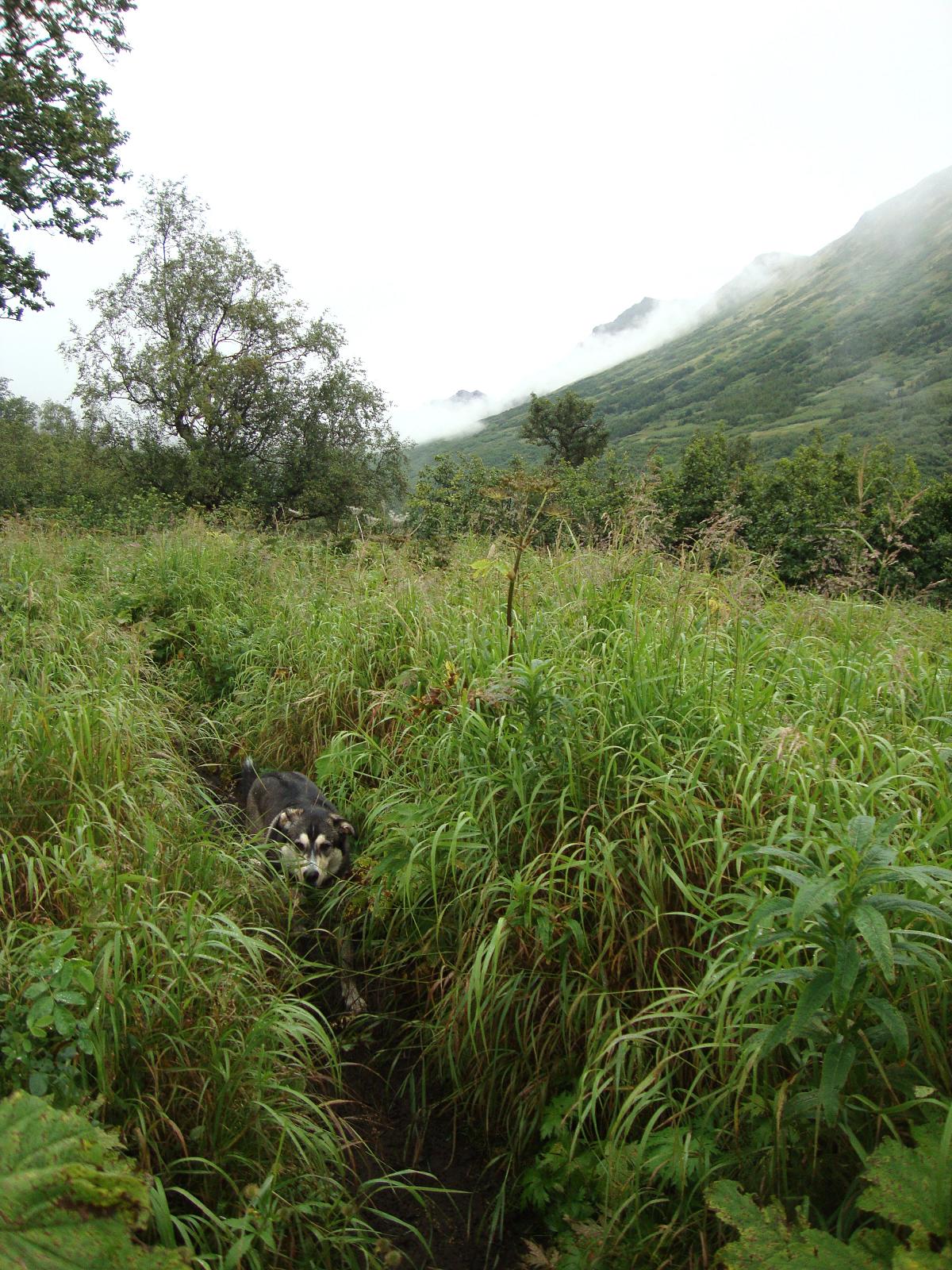
In just 15 minutes or so from the research centre door, we stashed the bike, locked it to a tree, and headed up the trail. Since we're starting at the base of the mountains at only around 50 metres elevation, and not at one of the established trailheads that are at 300 to 600 metres, we have a longer, and steeper route to do, to get above treeline. With my 16 kg pack, that means a slower time of it. We run on this trail 4-5 times a week, usually only up to about 500 metres, as it gets very steep above that level. It is also very brushy, with tall grass and shrubs closing it in, making it difficult to see roots and rocks, or a bear, in the distance. It took about an hour to get the 5 km up toward tree-line.

Once we got up to around 600 metres, we could see the city above the lowest cloud layer, kind of a gloomy scene. Which has been the case for much of this summer, unfortunately.
There were higher clouds as well, and as we ascended further, went in to the fog, at around 800 metres. This is a very steep portion of the trail, that leads to a point, then a saddle, then several more points, before reaching the summit of Konoya point, at 1425 metres (4670 ft.)

We reached a saddle beyond the first two points, at around 1000 metres, about 10 KM, and two and half hours in. This little pond had about a metres depth of water in it, when we were last here in late June. Unfortunately, that was from snow melt, and now just water-bug infested puddles were left in it. But it was good enough for Mattie and Homer, and I actually cooked with it, just straining out the parboiled bugs after it boiled, since I needed boiling water for my dehydrated dinner. It stopped raining overnight, and friday morning dawned partly sunny and breezy.

We left the established trail, and went over the edge of the Campbell Creek canyon, and began sidehilling down into it. Our map showed a route/trail on the north side of the canyon, which we hoped to intercept, so that we hopefully would not have to brushwhack. At first we had easy going in the stunted tundra vegetation of grass, dwarf willows and birch, and berries (the blueberries are ripe now, very tasty!). But as we got lower, shrub willow and alder and stunted hemlocks made their appearance, and, no route/trail. The map was wrong.

So we had about an hour of nasty brushwhacking through these, to get to Campbell Creek, which we needed to cross. Unfortunately, I had forgotten to bring my scuba diving booties, which I usually use for creek crossings, so that I can keep my boots dry. The creek here was too wide to jump across with a pack on, so I just had to plow through. That meant wet, cold socks and feet from then on, the rest of that day. It's wider than it looks in this picture, trust me. I'm proud of Homer though, he doesn't like getting in water much, like most sled dogs, but plowed right through.

We did find the trail/route, on the other side of the creek, and it made the going much faster, though it would fade in and out at times. We had about 12 KM more to go up the canyon, to Long Lake, where we thought we might camp for the night. Looking up the slope of Konoya point, to the north, we could see sheep in the distance, always worth bringing our binoculars.
The wind really began howling directly down the canyon, as we headed in. That was a sign to me, that perhaps another weather system was moving in. The forecast models had indicated high pressure ridging for today, when I looked at them on wednesday, could they be wrong?

As we got up to Long Lake, a few hours later, Mattie came back from one of her many side trips with a nasty gash on her right front paw. This was cause for concern, as it was bleeding profusely, and we might have had to turn back.
I helped her into the cool 5C or so waters of the lake to soak it, and that seemed to help. After a little wait, we started up again. She wasn't limping, so that was a good sign.

At this point, the wind really began to howl, the clouds thickened, and it started sprinkling. Looked like the models were wrong.
Half-metre swells with little whitecaps were forming on the beautiful pale blue surface of Long Lake, so the winds were probably blowing around 45-55 KPH here, enough for what we would categorise as a Small Craft Advisory, in our marine forecasts. Note how there are no trees or large shrubs here, at just 950 metres elevation. It is so cool and windy here in summer, that tundra vegetation is all that can survive.
We found what we thought to be a slightly wind-sheltered spot at the base of a ridge, at the eastern end of Long Lake. Behind it reared the majestic headwall of 1659 metre Williwaw Peak (5440 ft). I quickly set up my amazingly light 0.9 kg Big Agnes SL1 tent, which is just big enough for me and a pack. Then I left my pack and most of our supplies there, and we went further up the route. On my map, a string of lakes were shown, with a 350 metre pass separating two of them. We had to check this out, and look across the pass. For a real trail does come up the other side, the Williwaw Lakes trail, I wanted to see if I could find it, for future reference.

Just 100 metres higher and a kilometer behind camp, we found this next lake, Brush Lake, and were captivated by its beautiful pale blue colour, which we only ever see in the high country, fed from glaciers or permanent snowfields.

We stopped for a few minutes to admire the scene and get some pictures. It was still windy, and starting to rain a little harder. Our self portrait even turned out here.

I think my favourite scene is this one though, just a little further up the route, toward the actual pass. The top of Williwaw and adjacent peaks were obscured more now in the clouds, as the rain picked up.

It only took about another 30 minutes or so, to get to the pass, and look back both ways. Very beautiful, and well worth the trip.

On one side, the little blue gem of Brush Lake. And, on the other, down a very steep drop-off of 300 metres or so, Williwaw Lake, and I could see the real trail, on it's north side. Some time before late September, if we have an actual nice day, we're going to do a 50-70K all-day fast-pack from the research centre, up that trail and around, then back.
We just hung around the summit for a few minutes, went down slightly, then back up, and down again to camp. As it really began to rain in earnest, at this point, by 1600.
By 1700, a full-force east-wind gale and moderate rain was occurring, and I had to beat a hasty retreat into my little tent. Poor Mattie and Homer had to stay out in it, but Mattie doesn't like tents, so even if it was larger, that would have been the case. For two hours I just read a book and hoped the wind and rain would drop off, but it never did. I didn't feel like cooking, so just had snacks. The east winds, which must have been 60-90 kph, judging by how the little tent was rocking, and rain continued until at least 0500! Finally, I woke up at 0730 saturday, and the sun was partially out. Though it was still windy, but only about half as strong as earlier. Amazingly, Mattie and Homer seemed to be none the worse for the wear, after being out all night in those nasty conditions. But they just wrapped themselves into a ball, and rode it out.

We had a quick breakfast in the nice, dry, breezy weather, and by 0900 were packed and on the trail again. I wanted to be on the way out, in case the weather got worse again.
The plan for the return trip was a little different. We would go back the same way down the canyon, but instead of crossing Campbell Creek again, find the trail that goes up from it, to Near Point, on the south side of the canyon. And from there, take the well established trails back to the Tank Road, and the stashed bicycle.

I had seen this trail last April on my Near Point fast-pack, but as we got down the canyon, to where we thought it was, I couldn't see it. Then followed another hour of sweaty brushwhacking, followed by steep foot-stressing sidehilling up toward Near Point.
This is looking back up the canyon, just as we started sidehilling, and getting out of the worst of the brush. It got very steep quite soon from here.
You can see Near Point in the distance here on this next picture, the little knob in the middle. It is about 950 metres elevation, and looks right out over the Anchorage Bowl.

We found the trail when we were almost at the ridge behind Near Point. This was a relief for my feet to be on more level footing. We made Near Point at noon, and had a nice half-hour water/food break. It was sprinkling, and a little windy, but compared to the day before, quite comfortable. It took us three hours to drop down on the very muddy, sloppy trails from Near Point, then connect to other ones leading to the Tank Road and our bike. Which was still there and unmolested. We got back to the research centre at 1530, after leaving camp at 0900, which wasn't too bad for our 16 km hike, what with the brushwhacking and heavier pack, and all. Mattie's cut paw was bleeding a little more, but fortunately not as bad as the day before. All in all, we had a great time, in spite of the weather, seeing these beautiful, protected areas. And especially, that we could do it NEUTRALLY! How fortunate we are here. Cheers.